


Product Introduction
1,408-Channel Full-Constellation Processing
Equipped with a next-generation GNSS SoC featuring 1,408 channels, it supports all systems including BDS, GPS, GLONASS, Galileo, QZSS, and IRNSS, and is fully compatible with the new Beidou-3 frequencies (B1C, B2a, B2b). It achieves rapid global positioning, with single-unit initialization in under 10 seconds and reliability exceeding 99.99%.
· RTK Accuracy: Horizontal ±(8+1×10⁻⁶D) mm, Vertical ±(15+1×10⁻⁶D) mm
·Static Accuracy: Horizontal ±(2.5+0.5×10⁻⁶D) mm, Vertical ±(5+0.5×10⁻⁶D) mm
Professional Dual Cameras: One-Step Image Measurement
Equipped with professional starlight night vision dual HD lenses, supporting non-contact image measurement with an operating range of 2–15 m and accuracy of 2–4 cm.
·Real-world stakeout: Handheld device captures images and coordinates in real time; AR visual guidance makes stakeout points immediately clear, boosting efficiency by 50%+.
·Low-light adaptation: Starlight night vision technology ensures stable operation at night or in shaded environments.
Intuitive Inertial Navigation: Tilt-Compensated Measurement Without Calibration
Built-in next-generation high-precision IMU supports tilted measurements from 0° to 60°. Automatically initializes upon startup and performs attitude compensation without requiring a fixed solution.
·Tilt accuracy: 8 mm + 0.7 mm/° tilt; accuracy < 2 cm within 30°. Measure instantly upon arrival at complex terrains such as steep slopes and depressions.
·Smart Anti-Shake: Minor vibrations during operation do not affect results, allowing even beginners to achieve stable results.
Product Parameter (specification)
| Category | Item | Specification |
| GNSS Configuration | Channels | 1408 |
| Satellite Tracking | BDS: B1I, B2I, B3I, B1C, B2a, B2bGPS: L1 C/A, L1C, L2P(Y), L2C, L5GLONASS: L1, L2GALILEO: E1, E5a, E5b, E6QZSS: L1, L2, L5, L6*IRNSS: L5SBAS: L1, L2, L5L-BAND | |
| Output Format | ASCII: NMEA-0183, Binary Code | |
| Positioning Output Frequency | 1Hz ~ 20Hz | |
| Static Data Format | GNS, RINEX Dual-format Static Data | |
| Differential Format | RTCM2.x, RTCM3.x | |
| Network Mode | VRS, FKP, MAC; Supports NTRIP Protocol | |
| System Configuration | Operating System | Linux Operating System |
| Data Storage | Built-in 8GB ROM, supports automatic cyclic storage of static data | |
| Accuracy & Reliability | RTK Positioning Accuracy | Horizontal: ±(8 + 1×10⁻⁶D) mmVertical: ±(15 + 1×10⁻⁶D) mm(D = distance between measured points) |
| Static Positioning Accuracy | Horizontal: ±(2.5 + 0.5×10⁻⁶D) mmVertical: ±(5 + 0.5×10⁻⁶D) mm(D = distance between measured points) | |
| DGPS Positioning Accuracy | Horizontal: ±0.25m + 1ppmVertical: ±0.50m + 1ppm | |
| SBAS Positioning Accuracy | 0.5m | |
| Tilt Measurement Accuracy | 8mm + 0.7mm/° tilt | |
| Image Lofting Accuracy | Typical accuracy: 1cm | |
| Image Measurement Accuracy | 2cm ~ 4cm | |
| Initialization Time | < 10 seconds | |
| Initialization Reliability | > 99.99% | |
| Breakpoint Continuation | Maintains RTK measurements during differential signal interruptions | |
| Camera | Resolution | Professional dual HD cameras: 2MP & 5MP |
| Functions | Supports real-scene lofting and image measurement, working distance: 2~15m | |
| Communication Unit | I/O Ports | USB Type-C port; SMA port |
| Cellular Communication | Built-in eSIM card with 3-year data service; High-precision positioning right out of the box | |
| 4G Network Communication | TDD-LTE, FDD-LTE, WCDMA, TD-SCDMA, EDGE, GPRS, GSM | |
| Wi-Fi Communication | 802.11 b/g, supports AP and client modes; provides Wi-Fi hotspot service | |
| Bluetooth Communication | Bluetooth® 4.0/2.1+EDR, 2.4GHz | |
| Built-in Full-Protocol Radio | Power: 0.5W/1W/2W adjustableFrequency band: 410MHz~470MHzProtocols: HI-TARGET, TRIMTALK450S, TRIMMARKIII, TRANSEOT, SOUTH, CHC, SATELChannels: 116 channels (16 configurable) | |
| HDL460A Radio (Optional) | Power: 10W/30W adjustableFrequency band: 403~473MHzProtocols: HI-TARGET, TRIMTALK450S, TRIMMARKIII, TRANSEOT, SOUTH, CHC, SATELChannels: 116 channels (16 configurable)Transmission rate: 19.2kbps / 9.6kbps adjustable | |
| Sensors | Electronic Bubble | Enables intelligent centering |
| Tilt Measurement | Built-in high-precision inertial navigation with automatic attitude compensation | |
| User Interface | Buttons | Single button |
| LED Indicators | Satellite light, Signal light, Power light | |
| Functional Applications | Advanced Features | NFC flash connection, WebUI interaction, USB disk firmware upgrade |
| Smart Applications | Intelligent voice, function self-inspection | |
| Remote Services | Message push, online upgrade, remote control | |
| Cloud Services | Device management, location service, collaborative operation, data analysis | |
| Physical Characteristics | Host Battery | High-capacity lithium battery 7000mAh, working time better than 24 hours |
| External Power Supply | USB 15W charging | |
| Dimensions | Φ130mm × 80mm | |
| Weight | ≤ 0.97kg | |
| Material | Magnesium alloy housing | |
| Environmental Characteristics | Dust & Water Resistance | IP68 |
| Drop Resistance | Withstands natural fall from 2m high measuring rod | |
| Relative Humidity | 100% non-condensing | |
| Operating Temperature | -45℃ ~ +75℃ | |
| Storage Temperature | -55℃ ~ +85℃ |
Notes (translated for reference)
[1]QZSS L6 is available via firmware upgrade.
[2]Measurement accuracy, reliability, and initialization time depend on factors including tilt angle, number of satellites, geometric distribution, observation time, atmospheric conditions, and multipath effects; data obtained under normal conditions.
[3]Irregular operations such as rapid rotation and high-intensity vibration may affect IMU accuracy.
[4] Battery working time depends on working environment, operating temperature, and battery life.
Product Feature And Application
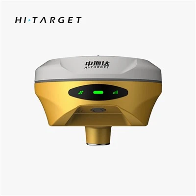
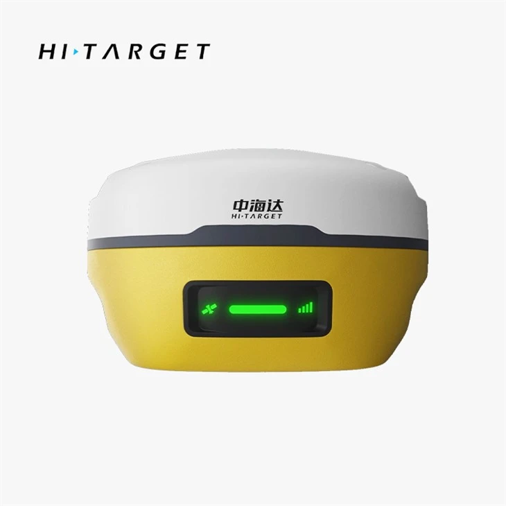
Hi-Target V5 is an imaging RTK device that combines surveying and staking out in one seamless process.

Professional dual-camera measurement and layout-all in one step
■ Contactless measurement significantly expands the usable range of GNSS, ensuring efficient and safe operations.
■ High-performance image processing technology based on Android enables real-time coordinate acquisition via the handheld device, with an operating distance of 2–15 meters and an accuracy of 2–4 centimeters.
■ Seamless switching between 360-degree AR staking on the handheld device and image-based staking on the base station provides an immersive staking experience that is both fast and accurate, with precision better than 1 centimeter.

Real-world layout-done right the first time
■ By combining RTK with imagery, survey points are marked directly on the ground in the image, enabling quick and precise point location in a single step.
■Seamlessly switch between 360-degree AR staking on the handheld device and real-world staking on the main unit for an immersive staking experience that is both fast and accurate, with precision better than 2 cm.

All constellations, all frequency bands
Built-in multi-protocol transceiver
■ Next-generation GNSS SoC chip with 1,408 channels, supporting RTK processing for the new BeiDou-3 satellite frequencies B1C, B2a, and B2b,
■Integrated multi-protocol transceiver with built-in radio, compatible with power and frequency adjustments for RTK radios from various domestic and international brands; typical operating range of 7 kilometers

Prodection Details


Prodect Qualification

Exihibition Show

Deliver, Shipping And Serving

Latest News
Shandong Surveying Information Technology Co., Ltd. is a professional manufacturer and one-stop supplier of surveying and mapping instruments, with nearly 20 years of industry experience. We specialize in the production of RTK receivers, automatic levels, total stations and theodolites, and also act as an authorized agent for multiple well-known industry brands, covering a full range of engineering surveying tools, measuring instruments and experimental equipment. We integrate production, global trade, technical support and after-sales service, committed to providing global customers with high-quality products and professional solutions. We look forward to cooperating with you!


Hot Tags: hi-target gnss rtk dual camera v5, China hi-target gnss rtk dual camera v5 manufacturers, factory, Hi Target Android Total Station, Hi Target Gnss Rtk Base Station V98, Hi Target Gnss Rtk Dual Camera V5, Hi Target Gnss Rtk V300, hi-target